New ANU centre to target bushfires through satellites, GPS-guided water gliders
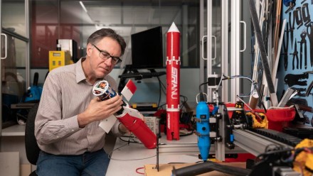
A centre of excellence will be established at the ANU in Canberra which will roll out a network of infra-red heat-sensing cameras, autonomous water-carrying gliders and, within a few years, satellite systems to provide an early bushfire detection and suppression system.
The $6 million dollar partnership between the ANU and telecommunications company Optus had its gestation in November last year and over the next four years will develop into a networked system which, at its fruition, will have a dedicated geostationary satellite "watching over" the continent for bushfire outbreaks.
The head of the project, Dr Marta Yebra, said this technology-based solution would use multiple platforms to tackle the bushfire detection issue, starting by working with the Rural Fire Service to mount long-range, heat-sensing cameras across the ACT's four established fire towers in readiness for the coming season.
"In optimal conditions, the cameras can detect up to 10 kilometres so they will be a very useful addition in the short term," she said.
"Later we can look to expanding the network to 10 cameras so we can cover much larger areas of the ACT and even beyond."
The next element to the program coming in 2022 is so-called "cube sats", tiny satellites which would loop in polar orbits over areas of south-eastern Australia and take a couple of high-resolution images on each pass, providing regular aerial views of any bushfire outbreaks which need targeting and suppressing before they grow larger.
Read the full article on the Canberra Times website, featuring Dr Marta Yebra and Prof Robert Mahony


