New study shows wildfires increasing in size and frequency across Victoria
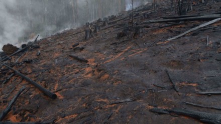
A new study by researchers at The Australian National University (ANU) has shown for the first time the full extent of the areas burned by Victorian bushfires over the past two decades.
Co-author Professor David Lindenmayer says the results indicate a major overhaul is needed when it comes to fire and land management.
The study maps where wildfires took place across Victoria between 1995, the start of the millennium drought, and 2020.
"This is the first time we've seen the full spatial extent of bushfires dating back 25 years," Professor Lindenmayer said.
"What we found is the state is burning more and more. Prior to 2000 we had one mega-fire in Victoria in 150 years of records. Since 2000 we've already had three.
"We can also see the extensive and frequent re-burning of previously fire-damaged areas - sometimes with a gap as short as five or six years.
"These results make a compelling case for a major policy shake-up, with the aim of reducing mega-fires, protecting unburnt areas and managing repeatedly damaged ecosystems."
In the 2019-2020 season alone, wildfires burned approximately 1.5 million hectares in Victoria - roughly double the size of the entire Melbourne metropolitan area.
"This is the largest area impacted by wildfires in Victoria since 1939, when 3.4 million hectares burned," Professor Lindenmayer said.
"Of the 1.5 million hectares burned during the 2019-2020 fire season, more than 600,000 hectares have burned twice, and more than 112,000 hectares have burned three times over the past 25 years."
Professor Lindenmayer says if we don't make changes to fire, resource and conservation policies, vital ecosystems and livelihoods will be at risk.
"We can no longer look at bushfires as unexpected out of the blue events. The data tells us they're only becoming more frequent," he said.
Read the full article on the ANU Science website, featuring commentary by Prof David Lindenmayer


